


PRECINCT BLOOM TOWNSHIP, Seneca County, Ohio
About
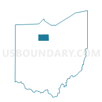
Outline

Summary
| Unique Area Identifier | 651583 |
| Name | PRECINCT BLOOM TOWNSHIP |
| County | Seneca County |
| State | Ohio |
| Area (square miles) | 35.88 |
| Land Area (square miles) | 35.79 |
| Water Area (square miles) | 0.09 |
| % of Land Area | 99.74 |
| % of Water Area | 0.26 |
| Latitude of the Internal Point | 41.03049360 |
| Longtitude of the Internal Point | -83.00609050 |
Maps


Graphs
Select a template below for downloading or customizing gragh for PRECINCT BLOOM TOWNSHIP, Seneca County, Ohio


Neighbors
Neighoring Voting District (by Name) Neighboring Voting District on the Map
- Voting District Chatfield Twp, Crawford County, OH
- Voting District Lykens Twp, Crawford County, OH
- PRECINCT BLOOMVILLE VILLAGE, Seneca County, OH
- PRECINCT CLINTON E, Seneca County, OH
- PRECINCT EDEN NORTH, Seneca County, OH
- PRECINCT EDEN SOUTH, Seneca County, OH
- PRECINCT REED TOWNSHIP, Seneca County, OH
- PRECINCT SCIPIO TOWNSHIP, Seneca County, OH
- PRECINCT VENICE TOWNSHIP, Seneca County, OH
- Voting District Texas Twp, Crawford County, OH
Top 10 Neighboring County Subdivision (by Population) Neighboring County Subdivision on the Map
- Clinton township, Seneca County, OH (4,109)
- Eden township, Seneca County, OH (2,188)
- Bloom township, Seneca County, OH (1,799)
- Venice township, Seneca County, OH (1,758)
- Scipio township, Seneca County, OH (1,729)
- Reed township, Seneca County, OH (848)
- Chatfield township, Crawford County, OH (724)
- Lykens township, Crawford County, OH (660)
- Texas township, Crawford County, OH (384)
Top 10 Neighboring Place (by Population) Neighboring Place on the Map
Top 10 Neighboring Unified School District (by Population) Neighboring Unified School District on the Map
- Tiffin City School District, OH (22,434)
- Wynford Local School District, OH (6,493)
- Mohawk Local School District, OH (6,284)
- Buckeye Central Local School District, OH (5,473)
- Seneca East Local School District, OH (5,152)
Top 10 Neighboring State Legislative District Lower Chamber (by Population) Neighboring State Legislative District Lower Chamber on the Map
- State House District 58, OH (120,471)
- State House District 81, OH (116,551)
- State House District 82, OH (111,625)
Top 10 Neighboring State Legislative District Upper Chamber (by Population) Neighboring State Legislative District Upper Chamber on the Map
Top 10 Neighboring 111th Congressional District (by Population) Neighboring 111th Congressional District on the Map
Top 10 Neighboring Census Tract (by Population) Neighboring Census Tract on the Map
- Census Tract 9742, Crawford County, OH (4,345)
- Census Tract 9638, Seneca County, OH (4,079)
- Census Tract 9625, Seneca County, OH (3,928)
- Census Tract 9741, Crawford County, OH (3,666)